

Literature-based case study | side-scan sonar target localization accuracy. When does a fine-resolution acoustic image justify a sub-metre target coordinate for remedial work?
The practical question
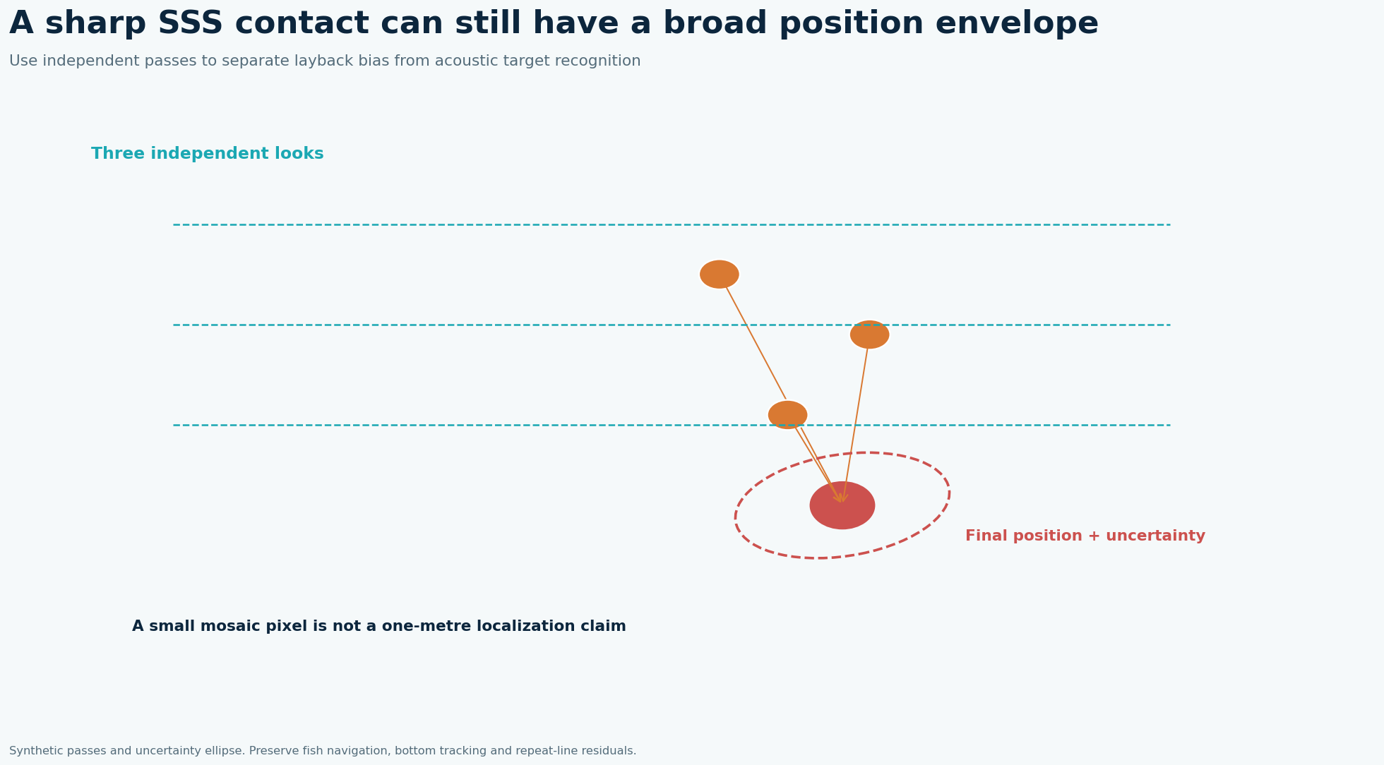
An attractive target image alone says little about position. Towfish navigation, range geometry, heading, timing, sound speed and the target’s position within the beam all contribute. The published phase-measuring system result is impressive because it checks acoustic detections against absolute target positions under particular shallow-water conditions; it does not upgrade every conventional towed SSS survey to the same accuracy.
What the published data actually say
In a shallow-water field trial using a 20 m sidescan backscatter range, 98.9% of ensonified targets were mapped less than 1 m from their absolute position. Source: Absolute Localization of Targets Using a Phase-Measuring Sidescan Sonar in Very Shallow Waters, Remote Sensing 2023. These are findings from that location and acquisition setup, not a GeoSubsea project or a universal equipment specification.
A defensible field-to-report solution
Define a target-position acceptance criterion in metres and a method to obtain independent truth. Calibrate transducer position, heading, attitude, sound speed and latency; survey a small set of known control targets from contrasting headings. Separate detection rate from localization error, calculate the distribution of horizontal offsets for targets actually ensonified, and retain missed or ambiguous detections as a separate metric. Require overlap and a confirmatory pass where target remediation depends on a narrow exclusion radius.
Worked decision example
The study’s 98.9% figure is conditional on targets that were ensonified, with 20 m range in its setup. It cannot establish the probability of finding every target in an unsurveyed blind strip. If a hypothetical 100 ensonified targets shared the same rate, around 99 might meet the <1 m criterion; this arithmetic is illustrative rather than the paper’s sample size.
What to record in the field
A localization trial should start with targets whose absolute positions have been surveyed independently at a quality better than the claimed sonar accuracy. Run passes at different ranges and headings and document heading, attitude, latency and sound-speed calibrations. Count all intended targets, then separate those actually ensonified, those detected and those localized within the tolerance. A denominator restricted to ensonified targets answers a different question from a whole-area probability of detection. This distinction matters when a missed UXO contact can invalidate a clearance claim.
How to make the engineering decision
The phase-measuring shallow-water experiment found 98.9% of ensonified targets within 1 m at a 20 m backscatter range. Its result is a useful validation example rather than a promise for a conventional towfish. For a new site, plot the distribution of horizontal error against range and target aspect and compare it with the exclusion radius for remedial action. If geometry or seabed clutter produces a long error tail, expand the buffer or perform a targeted verification pass. Publish both successful and unsuccessful contacts so the field trial can be audited.
QC gates before accepting the interpretation
Report number of controls, positions, independently measured truth, errors by range and aspect, and missed contacts. Validate on the actual system and water depth before transferring the <1 m expectation to a contract.
Limits and next action
Treat the result as a field demonstration of a particular phase-measuring setup, not the specification for ordinary SSS or arbitrary depths. For a project-specific decision, identify the required engineering tolerance, review the raw survey evidence and agree the validation method before acquisition or reprocessing.
Applied decision scenario
Suppose a phase-measuring trial maps nearly all ensonified controls within one metre, yet one contact near the far edge has a large error and several intended controls were never insonified. Do not remove those from the operational discussion. Report the conditional localization fraction beside coverage and detection fractions and examine range and heading for the outlier. If the planned intervention has a one-metre radius, even a low-frequency tail may matter. Validate a wider buffer or a close-range confirmation pass before declaring a narrow work area clear.
Questions to resolve before sign-off
Does 98.9% mean 98.9% of all objects will be found? No. The reported fraction concerns localization among ensonified targets in the study setup. A detection survey also has blind zones, coverage gaps, target-orientation effects and missed contacts. Keep denominators separate: intended, covered, detected and accurately localized targets. What should a commissioning trial include? Place independently surveyed controls across near and far range and contrasting headings. Document truth-position uncertainty and repeat a subset of passes. Plot the full error distribution, including its tail. If a remedial clearance radius is required, design the trial around that radius and state how an ambiguous localization triggers a closer pass or a larger exclusion zone.
Related geophysical services
GeoSubsea supports integrated side-scan sonar, sub-bottom profiler, multibeam and high-resolution 2D seismic processing, survey QC and interpretation. For a defensible site-specific assessment, start with the survey objective, raw data, positioning records and ground truth.
Explore GeoSubsea services · More case studies
Primary reference
Absolute Localization of Targets Using a Phase-Measuring Sidescan Sonar in Very Shallow Waters, Remote Sensing 2023. The figures above are original editorial illustrations; they do not reproduce source figures.
Leave a Reply